

Whitford Canyon
Happy Camp Road should have been the obvious choice

I’ve been taking photos for a few years in several areas around the Tonto National Forest including some near Superior Arizona. The photos are used in a volunteer project documenting changes in riparian areas in the Tonto National Forest. Whitford Canyon is one of those areas and is usually accessed by the pleasant sounding Happy Camp Road (FSR 650). Happy Camp Road (FSR 650) below Montana Mountain is a well maintained Forest Service road with access to the Arizona Trail and Reavis Canyon Trail. Beyond the Reavis Canyon/Arizona Traihead, FSR 650 becomes significantly more challenging and is certainly not recommended for passenger cars.
In April of last year, a friend and I decided to photograph the Whitford Canyon sites on the same day as the Benson Spring sites. After finishing Benson Spring, we decided to cut across to Whitford Canyon via FSR 518 past Perlite Spring instead of backtracking from Benson Spring and taking Happy Camp Road. Impulsive behavior is something that I’ve struggled with all of my surprisingly long life. However, several of the failures have led to interesting trips.

FSR 518 looked good at the Benson Spring turnoff but soon turned rough and rocky and shined up the bottom of my Forester in a few stretches. It was very slow progress crawling along the rocky but sometimes scenic route. The Subaru would have been much happier with Happy Camp Road.
After taking a short break at the perlite quarry, we drove on and took a right on FSR 982 (an equally rough road) and continued to Whitford Canyon at Barnett Camp. Barnett Camp may have been a “Camp” at some point but I haven’t seen any sign of it other than a name on the map.
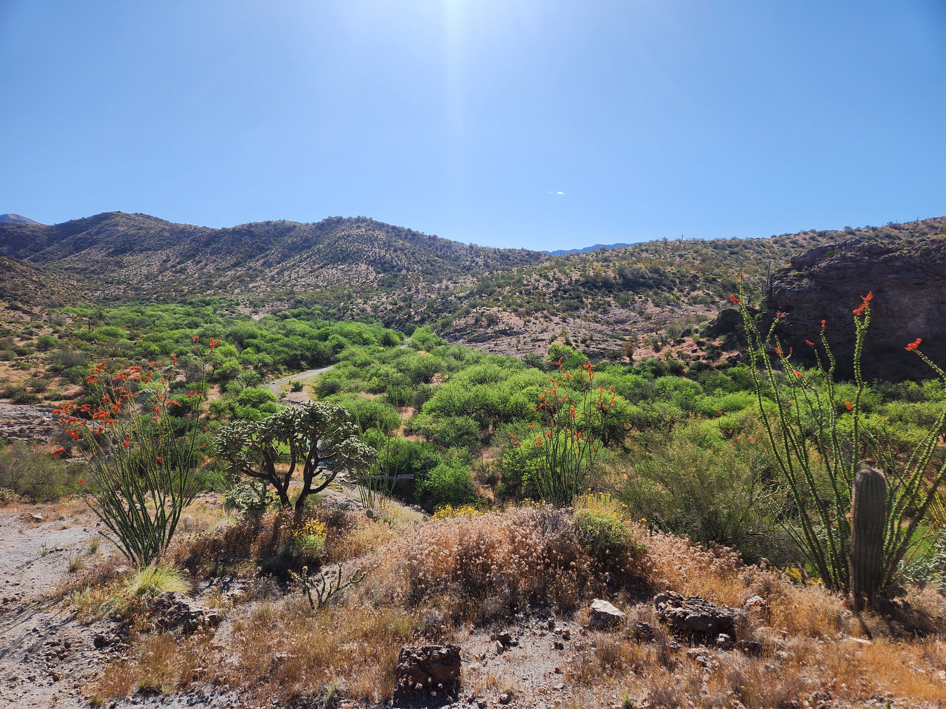
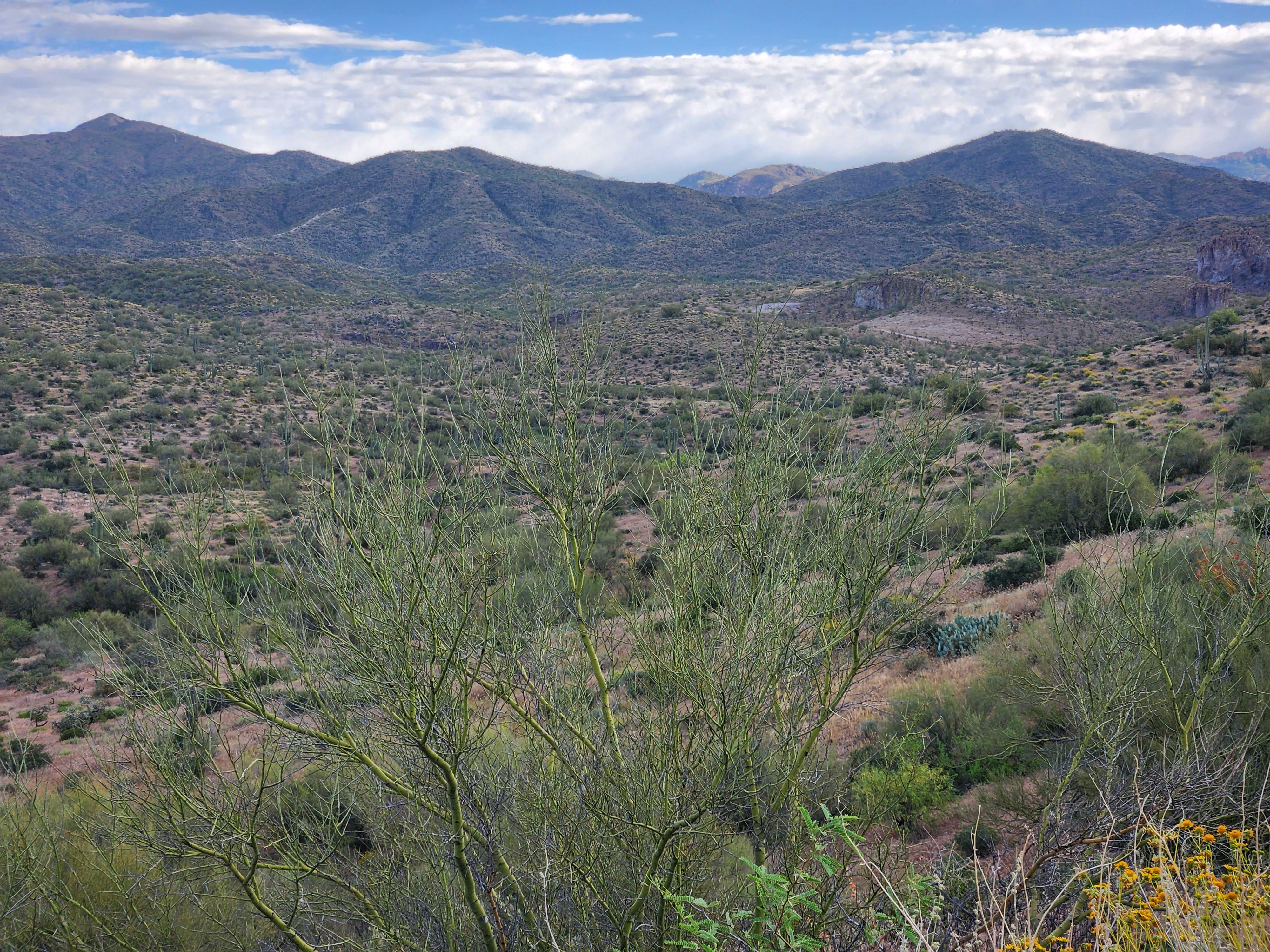
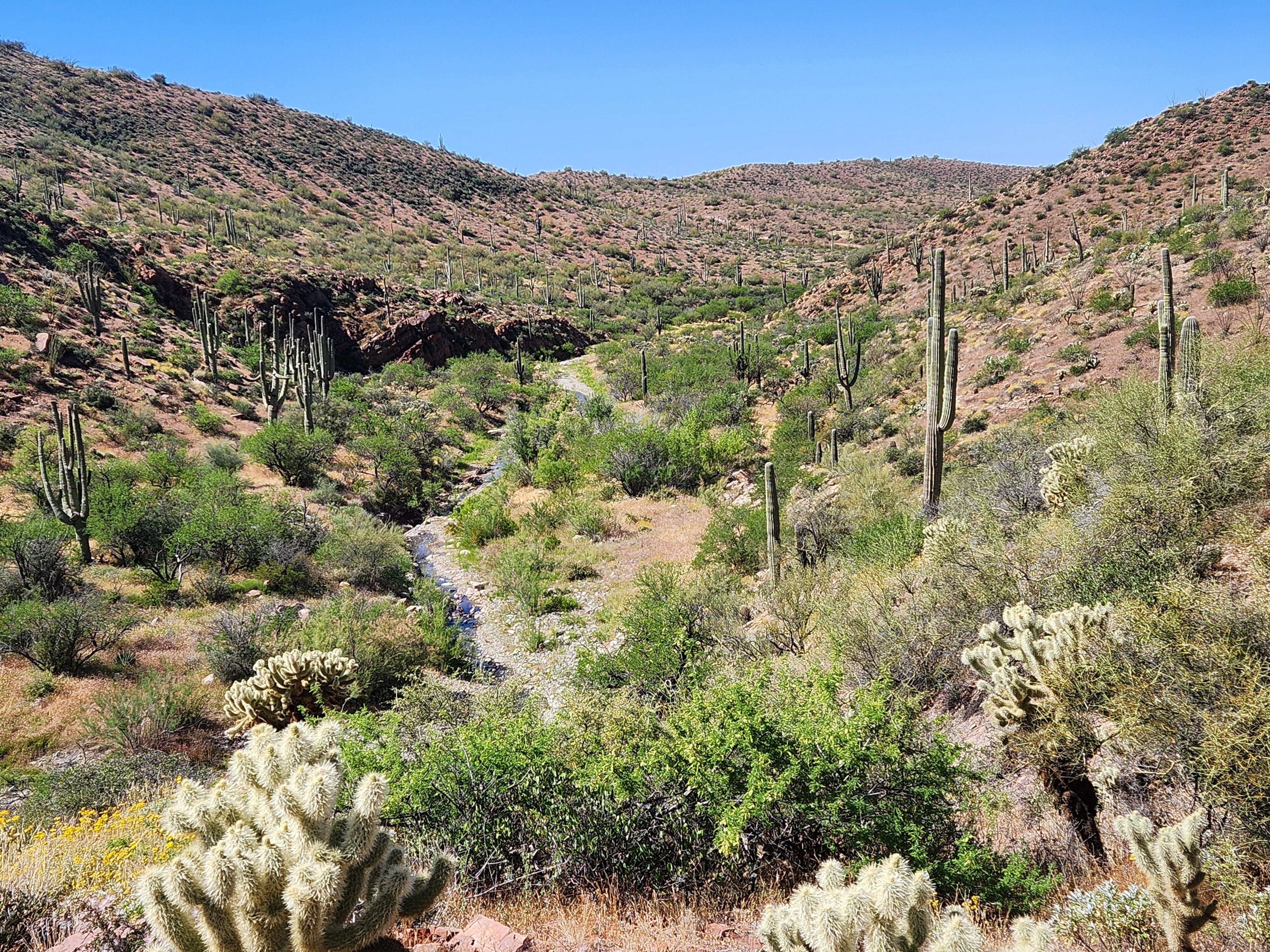
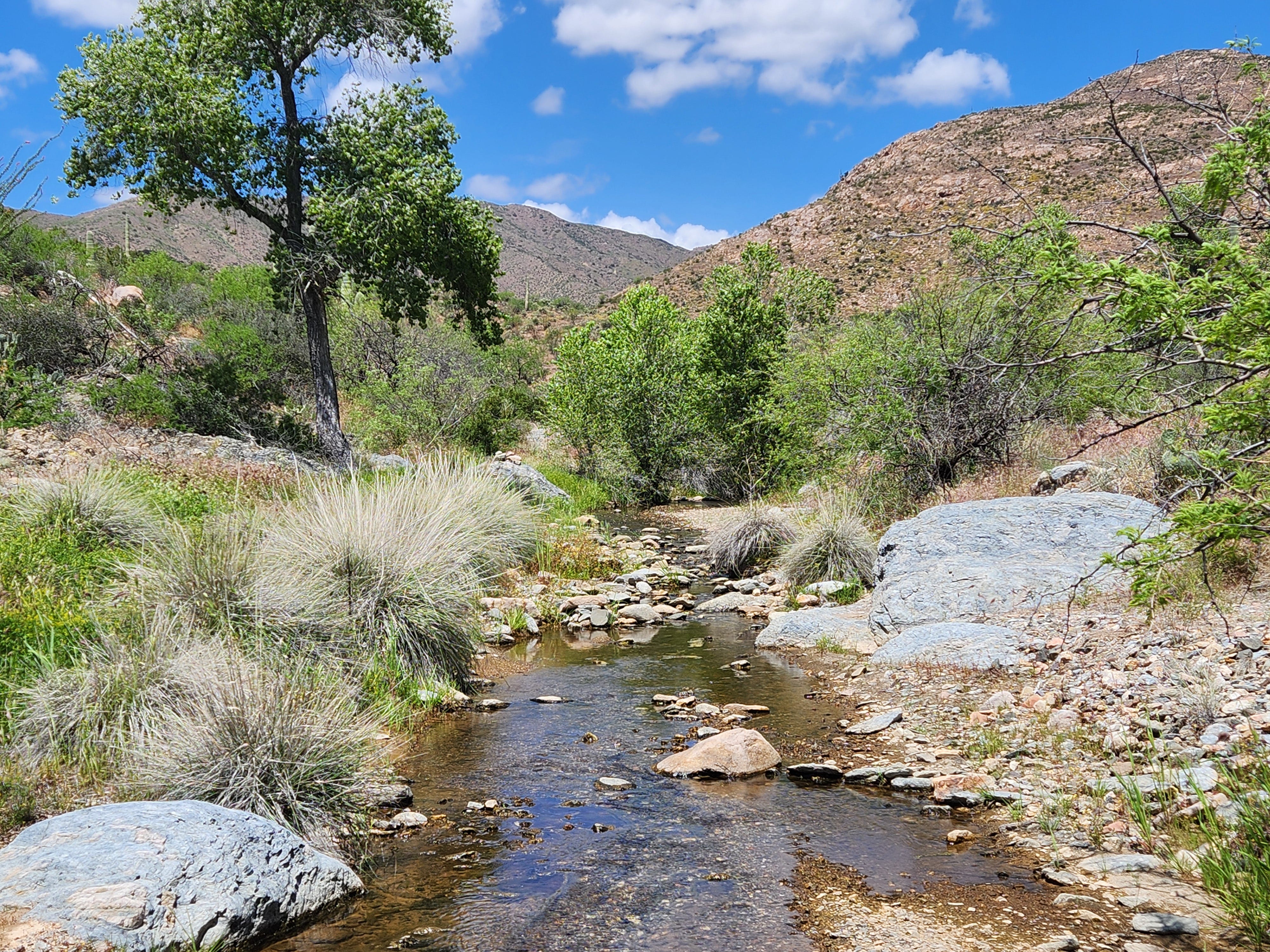
Photo Site #1 is on a bluff above Barnett Camp overlooking Whitford Canyon. Thanks to winter rains, the mesquite bosque in the riparian area was bright green this April and the ocotillo were sporting bright red flowers.
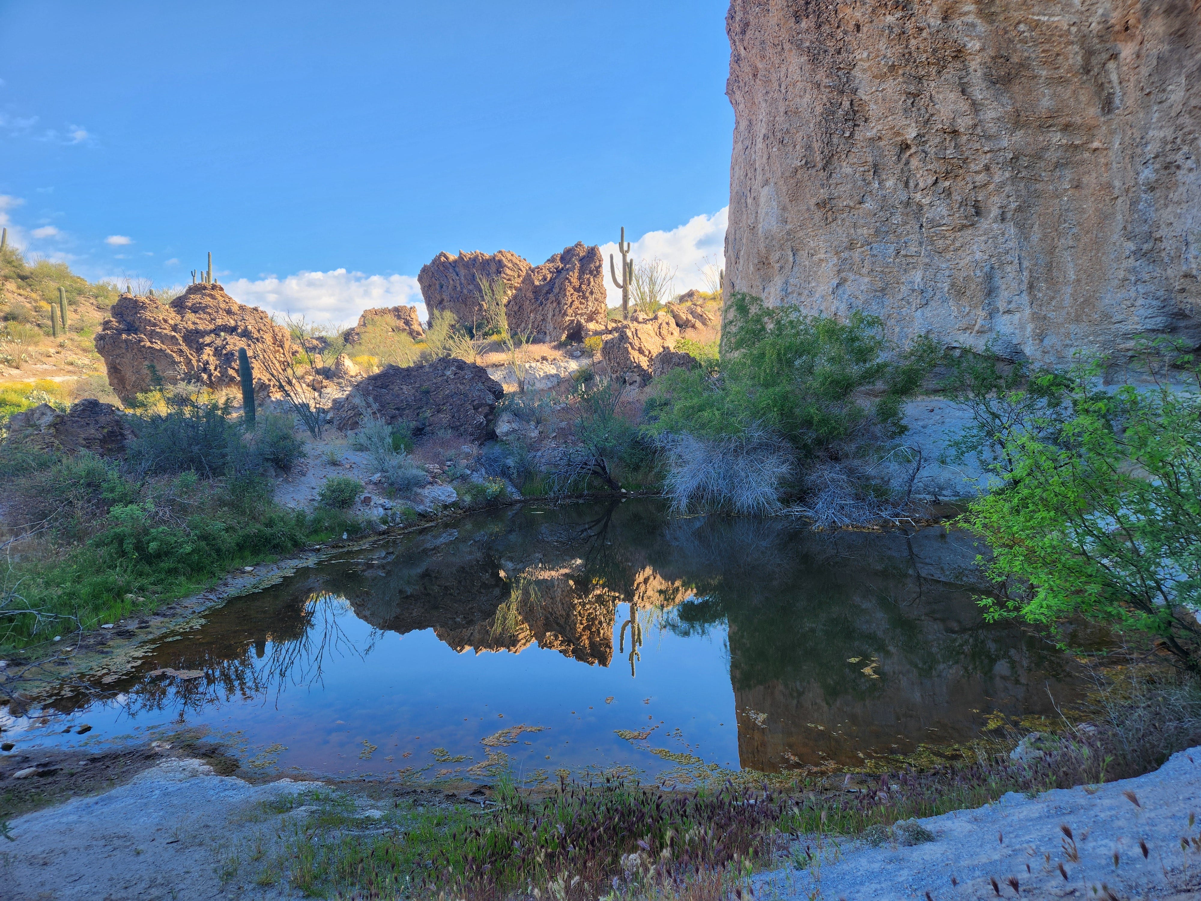
The Arizona Trail runs through Whitford Canyon from Site #1 to Site #2. Site #2 is out of sequence and located at the far end of the canyon. Site #3 is a short hike upstream from Barnett Camp. The area has been uplifted during some ancient era as evidenced by the tilted quartzite slabs in the creek bed at Site #3 and the corresponding tilt of the canyon walls at Site #6.
Another short hike up the canyon brought us to Site #4. The Arizona Trail exits the streambed near Site #4 and climbs a bluff above the stream to bypass a curvy section of the canyon. An overview facing downstream was photographed from the trail on the bluff.
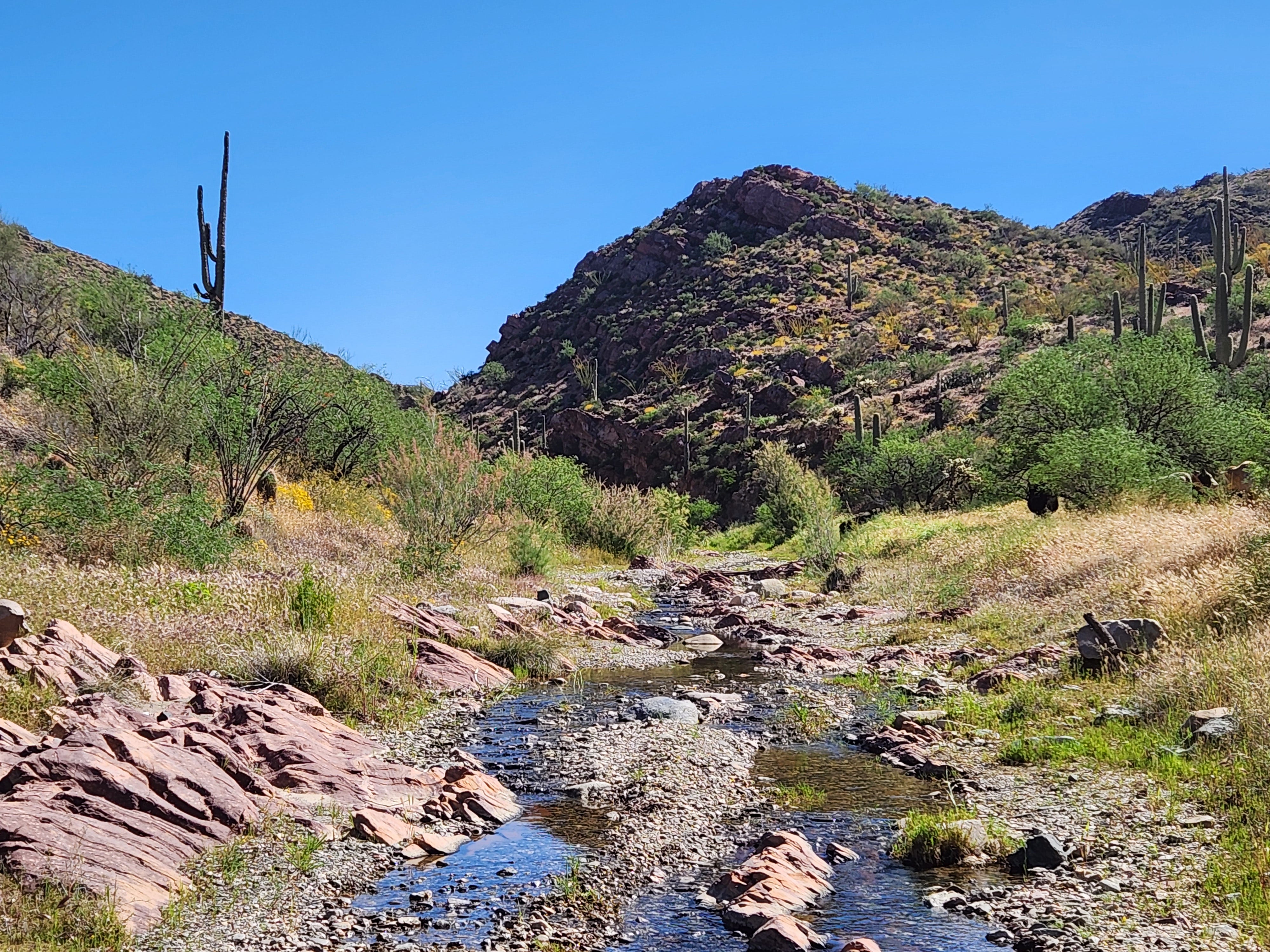
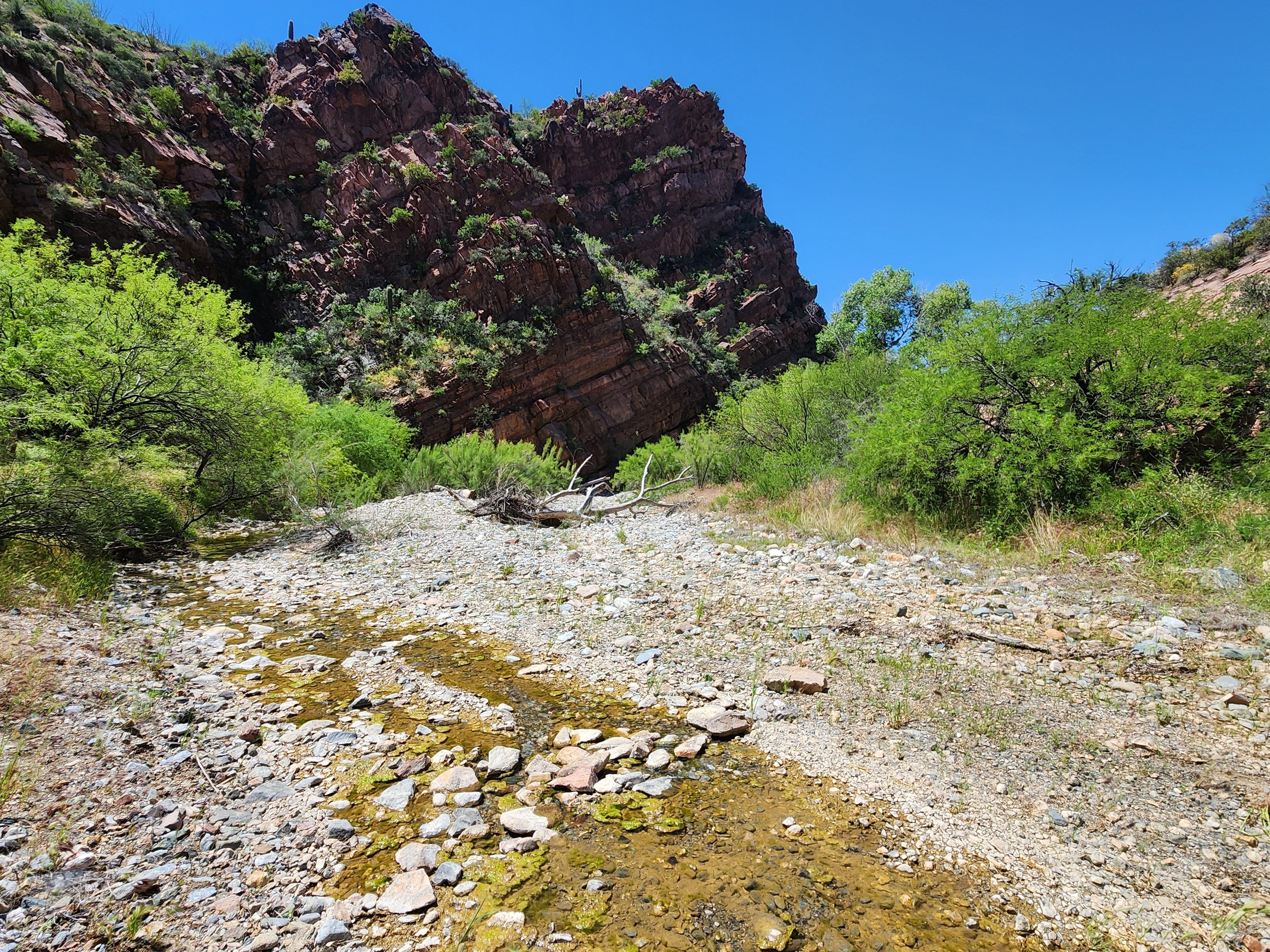
Next, we backtracked to Barnett Camp and climbed back into the Subaru for a rough ride east along FSR 985 to the intersection with Happy Camp Road and the remainder of the photo sites. It’s an easy drive to the access point for sites 5&6. We parked just past a creek crossing and hiked downstream along and through the canyon until we reached Site #6 located just before the creek curves around a red quartzite cliff.
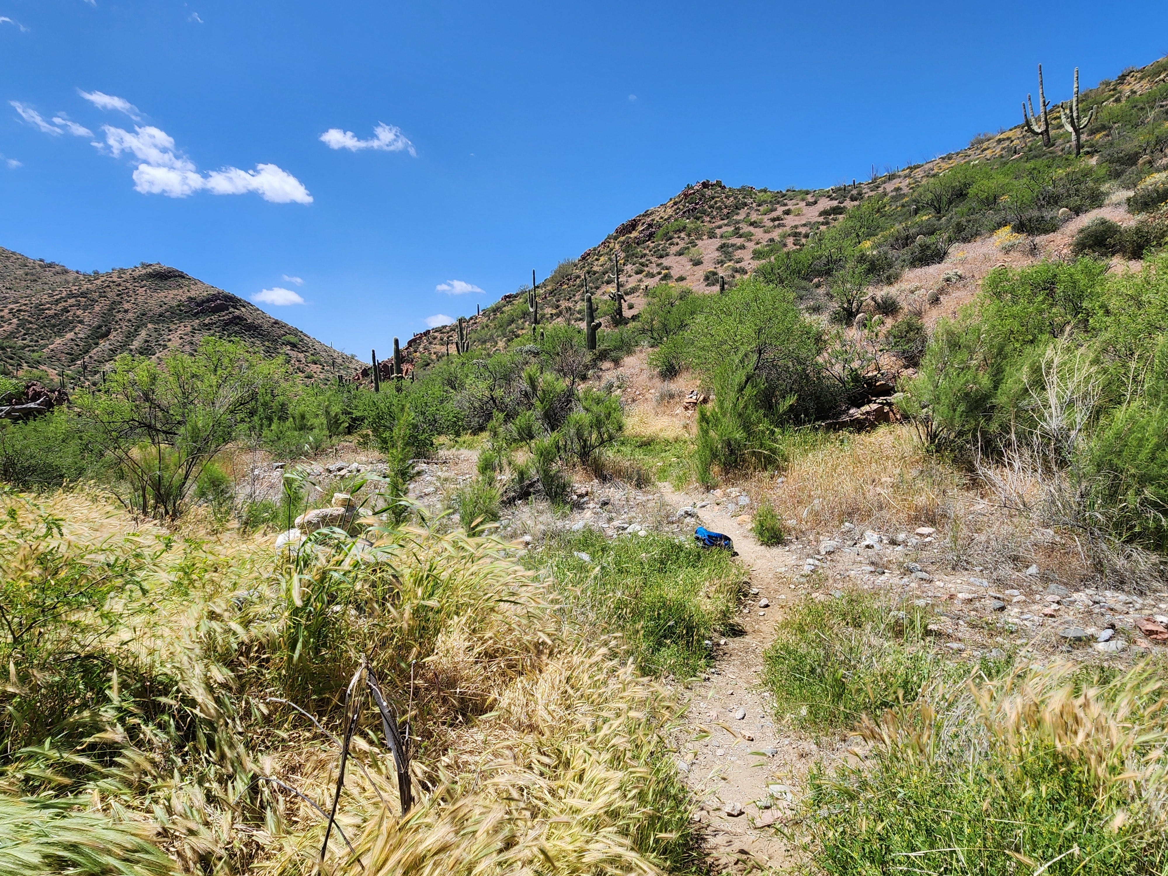
Site #5 is reached by continuing downstream until reaching a large rock cairn at the side of the trail.
At Site #5 we reversed again and hiked back to the car to continue to the access point for Site #2, the furthest upstream site. This portion of Happy Camp Road is well maintained until a Ranch and corral area is passed. Once past the ranch area, the road goes into and out of the creek bed and becomes rocky and narrow in places.
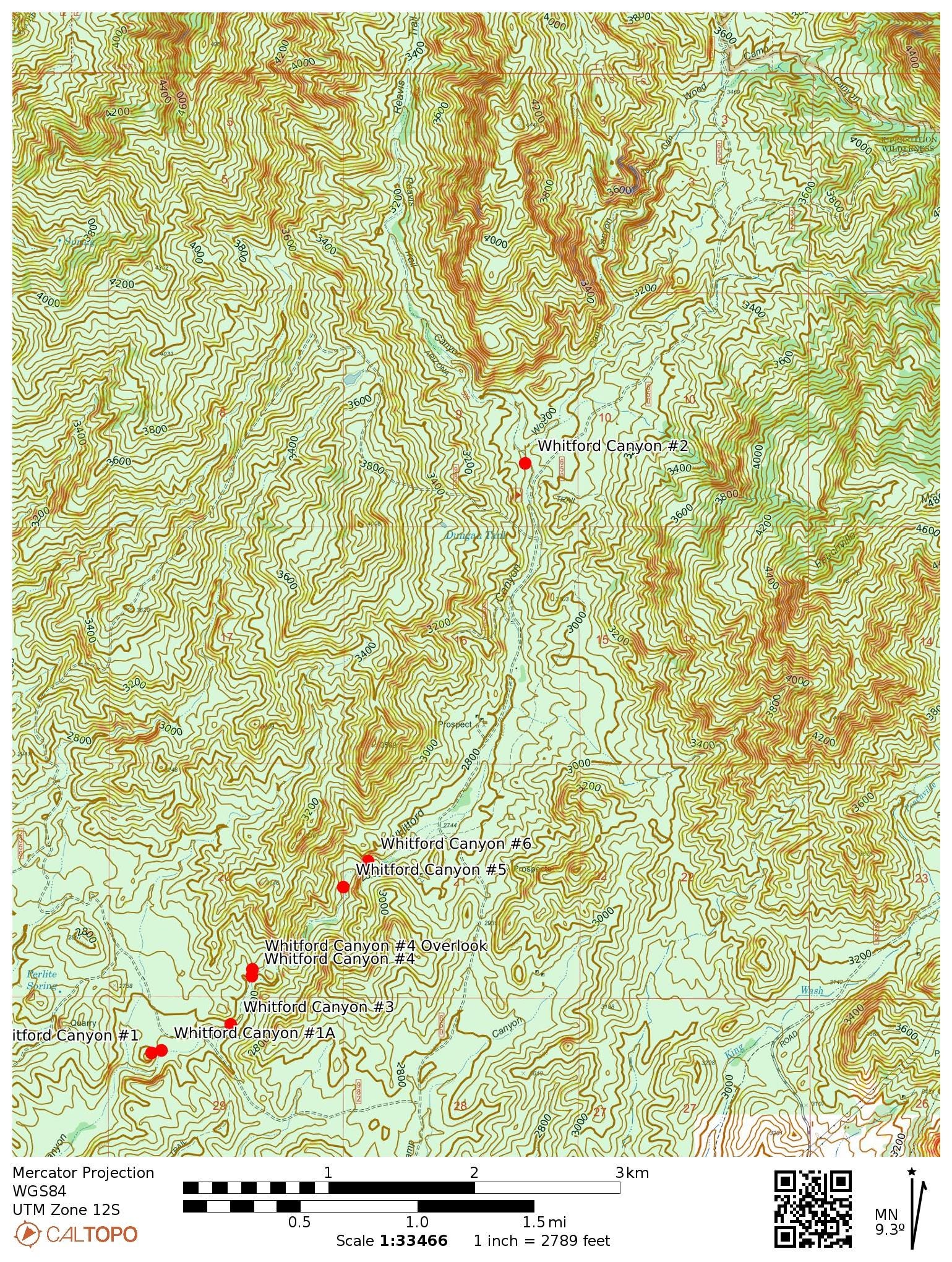
Site #2 is a short hike along the Reavis Canyon Trail from the Reavis Canyon Trailhead. The Arizona Trail follows the Reavis Canyon Trail then enters Whitford Canyon and exits to the south near Hewitt Station Road.
Reavis Canyon is named for Elisha Reavis a rancher who lived and died alone in the nearby Superstition Mountains. He raised vegetables and sold produce to the surrounding communities in the late 1800’s.
Once finished with the last site, we found our way back to US 60 then took a detour to Superior Arizona for lunch and a beer at Porter’s Saloon & Grill.
Raise a veggie for Elisha
Tim
Loved seeing all the pictures, and learned something new: I had no idea perlite was mined! Thanks for sharing!